This run is another great overnight or day run. There are a few remaining rapids before hitting the mighty Columbia and camp and fishing options abound.
The total run is around 45 miles but you can easily break that up into smaller chunks with many access options. A BLM access dirt road follows the river for most of its length here.
The river usually has good flows year round. The lower elevation here allows for winter paddling.
You will need a Boater Pass to float here. Checkin at Maupin for passes or more information.
| Class | III to III+ |
| Current Flow |
5870.0 CFS 05-17-2024 20:45 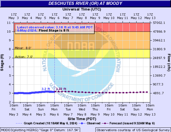
View River Forecast |
| Recommended Flow |
Minimum: 2500.0 Average: 4000.0 Maximum: 9000.0 |
| Typical Season |
Begins: January Ends: December |
| Recommended Use |
Kayaking: Yes Rafting: Yes Canoeing: Yes SUP: Yes Packrafting: No Fishing: Yes |
| Primary Gauge | DESCHUTES RIVER AT MOODY, NEAR BIGGS, OR |
| Length | 44.0 Mile(s) |
| Gradient | FPM |
| Type | Name | Description | Camping? | Water? | Boat Ramp? | Vehicle Access |
|---|---|---|---|---|---|---|
| Put-In | Buckhollow Access |
Below Sherar's Falls is the Buckhollow Access put in. This is a day use area with lots of parking and facilities. |
No | No | Yes | All Vehicles |
| Put-In | Pine Tree Access |
This is a day use area with a dirt ramp. |
No | No | Yes | All Vehicles |
| Put-In | Beavertail Access |
A small dirt ramp, camping access from river and by car, facilities and drinking water. BLM Fee area |
Yes | Yes | Yes | All Vehicles |
| Put-In | Macks Canyon Access |
This is a good take out or put in option to break up the lower deschutes. Macks Canyon has a campground as well as historical information about the Indians that used to occupy the area. This is also the beginning of a trail that heads downriver. This is a fee area. |
Yes | No | Yes | All Vehicles |
| Take-Out | Heritage Landing State Park Access |
Right above the confluence with the Columbia on river right is a nice paved ramp and day use facilities. |
No | Yes | Yes | All Vehicles |
| Rapid Name | Description | Scout | Class | Recommended Flow |
|---|---|---|---|---|
| Buckhollow Rapids |
Read and run class II |
II |
Minimum: 2500.0 Maximum: 9000.0 |
|
| Trestle Hole Rapid |
Just below the railroad trestle bridge is an island that splits the river. Let channel is basic class II. Right channel is a little tougher with a hole. |
Read and run |
II+ to III- |
Minimum: 2500.0 Maximum: 9000.0 |
| Wreck Rapid |
The river drops over a ledge here. Best route is to take the first wave train down from right to left. This rapid is named after a train collision that occurred here in 1949 |
III to III+ |
Minimum: 2500.0 Maximum: 9000.0 |
|
| Rapid |
A straight forward rapid |
Read and run |
II |
Minimum: 2500.0 Maximum: 9000.0 |
| Macks Canyon Rapid |
If you stay on the left channel this is mainly some small waves. |
II |
Minimum: 2500.0 Maximum: 9000.0 |
|
| Island Rapid |
2 small islands split the river into 3 channels as the river widens slightly here. This creates a shallow entrance into 1 of the 3 channels. Most right channel is probably the calmest with the most left channel the most turbulent. Any route is not going to be harder than class II water. |
Read and run |
II to II+ |
Minimum: 9000.0 Maximum: |
| Bull Run Rapid |
A wave train |
read and run |
II to II+ |
Minimum: 9000.0 Maximum: |
| Jet Pump Rapid |
read and run |
II+ |
Minimum: 9000.0 Maximum: |
|
| Harris Rapid |
Some rock dodging and waves |
Read and run |
II to II+ |
Minimum: 9000.0 Maximum: |
| Washout Rapid |
Large waves and a hole just right of center. Easiest line is probably just left of center down a fairly large V and wavetrain. |
Scout river left if you wish. |
III to III+ |
Minimum: 9000.0 Maximum: |
| Gordon Ridge Rapid |
A set of drops as the channel narrows. Yield to upcomming jetboat traffic if they are commited to their line. |
Read and run |
III to III+ |
Minimum: 9000.0 Maximum: |
| Colorado Rapid |
A short straight forward rapid |
Read and run |
III to III+ |
Minimum: 9000.0 Maximum: |
| Knock Knock Rapid |
This is an area with pretty turbulent currents and eddylines. This can flip unsuspecting kayakers. Rafters can float over the boils without too many issues. |
II |
Minimum: 9000.0 Maximum: |
|
| Rattlesnake Rapid |
Read and run |
III |
Minimum: 9000.0 Maximum: |
|
| Moody Rapid |
Take the left channel as you approach the take out. The channel narrows and creates a class III rapid. |
III to III+ |
Minimum: 9000.0 Maximum: |
| Camp Name | Description | Fee? | Beach? |
|---|---|---|---|
| Twin Springs Camp |
An open camp accessible from the river or by car. Toilet and not much shade here. BLM camp fee. |
Yes | No |
| Camp |
River left medium sized camp. |
No | No |
| Camp |
Large camp on river left. |
No | No |
| Camp |
Smaller to mid sized camp on river left. |
No | No |
| Jones Canyon Camp |
River right. Vehicle and river access. Full service fee based camp. |
Yes | No |
| Camp |
A so-so camp on river left. No shade. |
No | No |
| Camp |
River left camp |
No | No |
| Rattlesnake Canyon Camp |
This camp isn't very river friendly. River right. Fee area. |
Yes | No |
| Camp |
A large camp on river left. Good eddy pool with sandy beach makes this a nice camp even if the shade is limited. |
No | No |
| Camp |
A small camp on river left. |
No | No |
| Camp |
River left |
No | No |
| Talbot Camp |
River left medium sized camp with some shade. |
No | No |
| Upper Dike Camp |
River left. Medium sized camp with decent shade |
No | No |
| Dike Camp |
River left camp with a toilet. |
No | No |
| Sixteen Canyon Camp |
Large camp on river right. Toilet. |
No | No |
| Homestead Camps |
On river right on the river bend are a couple of large camps with good shade, a beach and a toilet. |
No | Yes |
| Nooky Rock Camp |
Good camp on river left. |
No | No |
| Airstrip Camp |
River left just north of the dirt airstrip. Toilet. |
No | No |
| Camp |
river right |
No | No |
| Camp |
2 or 3 primitive camps on river right |
No | No |
| Lockit Camp |
A couple of large camps with good shade and a toilet on river left. |
No | No |
| Camp |
River right |
No | No |
| Harris Camps |
A couple of larger camps on river left. Toilet |
No | No |
| Green Light Hole |
River left just after the rapids. Near the railroad tracks |
No | Yes |
| Fall Canyon Camp |
Larger site on river right. Toilet |
No | No |
| Camp |
river left. No campfires, dogs or camping while cattle present here. |
No | No |
| Camp |
River left. No campfires, dogs or camping while cattle present here. |
No | No |
| Camp |
River left. No campfires, dogs or camping while cattle present here. |
No | Yes |
| Deer Spot Camp |
Mid sized camp river right. |
No | No |
| Bedsprings Camp |
2 good sized camps on river right. Good shade and toilet. A small beach at the first camp. |
No | Yes |
| Hot Rocks Camp |
River right camp with good shade. |
No | No |
| Deschutes Camp |
Small camp on river left not far below washout rapid. |
No | No |
| Free Bridge Camp |
River left. |
No | No |
| Kloan Camps |
Several small camps on river left. This area can also be reached by 4WD on the free bridge road. |
No | No |
| Bathtub Camp |
River right, decent shade. |
No | No |
| Camp |
This is one of many small camps on river right in this area. You can find camps here from bathtub camp all the way down to commisioner camp. |
No | No |
| Game Commission Camp |
River right. |
No | No |
| Upper Shade Bar |
River left. |
No | No |
| Lower Shade Bar |
River left. Toilet |
No | No |
| Gordon Ridge Camp |
Located on river right about halfway down the rapid. Good beach with not a lot of shade. |
No | Yes |
| Five Trees Camp |
River right. Toilet. |
No | No |
| Wagonblast Camp |
Small camp on river left with toilet access. |
No | No |
| Colorado Camp |
Large camp on river right. Shade and pit toilet. |
No | No |
The following fish species are often found on this run. If you don't see a fish that you know lives on this river, please login and associate that fish species.
No Fish have been associated with this river yet...
| Name | Type |
|---|---|
| Ferry Canyon | Historical Place |
| Railroad Water Tower | Historical Place |
No external links or resources added yet...
No community notes added yet...
No Accidents reported for this run...
No River Shuttle Companies added yet...
No River Outfitters, Guides or Commercial Companies added yet...
No Camping or Lodging locations added yet...
